H
Instrumented hardware
Bars, sensors, nodes and electronics aimed at collecting information from accessible or strategically defined heap zones.
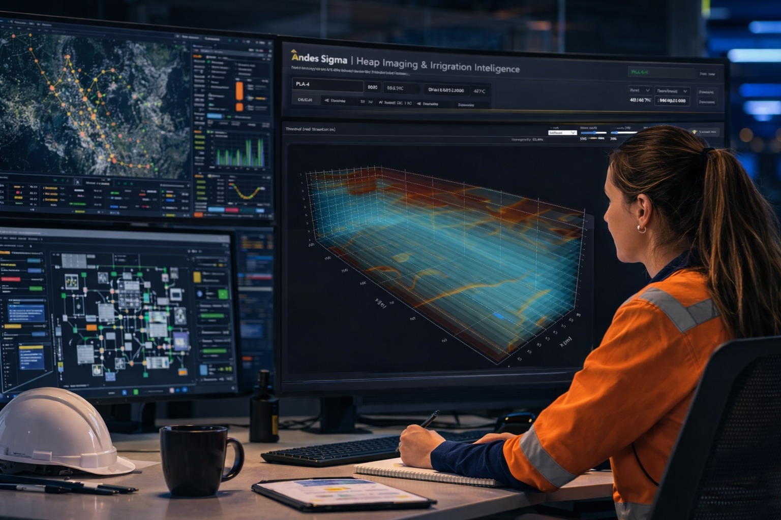
Hardware and software to diagnose internal irrigation in leaching piles through segmented measurement, wireless data acquisition, field photovoltaic power, impedance analysis, 2D/3D visualization, vertical tomography-like cuts, critical sections, KPIs and support for more controlled water use in mining.
Critical process
In a heap leaching operation, irrigation is not a secondary variable: it is the medium that allows the solution to contact the mineral and support the subsequent dissolution and recovery of valuable metals. At the same time, efficient and controlled use of water resources and process solutions is increasingly relevant for mining. Without enough internal visibility, a critical part of the business operates with incomplete information.
Andes Sigma solution
The solution combines field instrumentation, wireless data acquisition, photovoltaic self-charging, segmented depth measurements, impedance analysis and a technical-operational platform to visualize comparative irrigation distribution and its temporal evolution.
Bars, sensors, nodes and electronics aimed at collecting information from accessible or strategically defined heap zones.
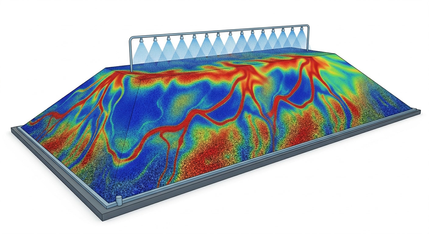
Segmented measurements to observe contrasts and changes by level, not only aggregated surface signals.
Field nodes transmit data without requiring extensive cabling between the heap and the monitoring platform.
Field equipment prepared for operation with solar photovoltaic power and recharge.
More evidence to observe irrigation distribution, avoid blind decisions and support a more controlled water operation.
KPIs, alerts and severity to follow critical conditions without relying only on surface visual inspection.
Platform
A platform that transforms real measurements into spatial visualization, comparative hydraulic diagnosis and operational alerts.
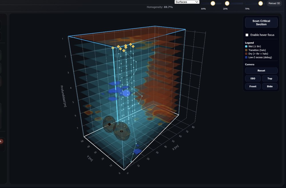
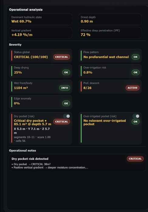
Hydraulic condition, risk, critical depth and relevant pattern indicators.
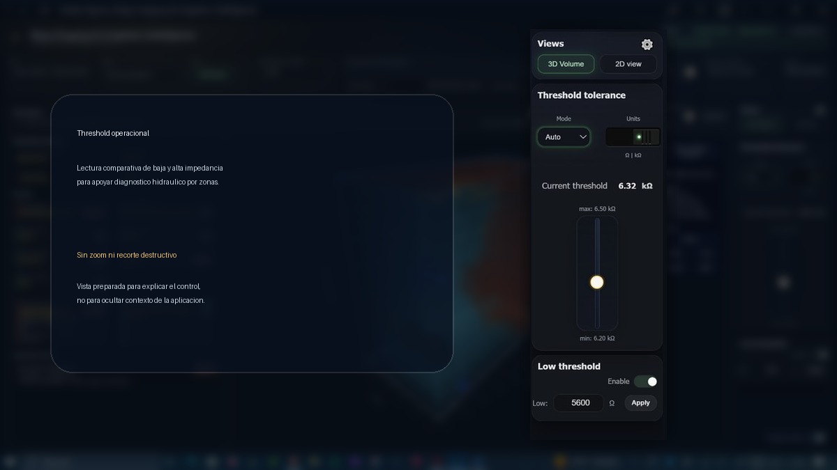
Operational configuration to interpret relative low- and high-impedance zones.
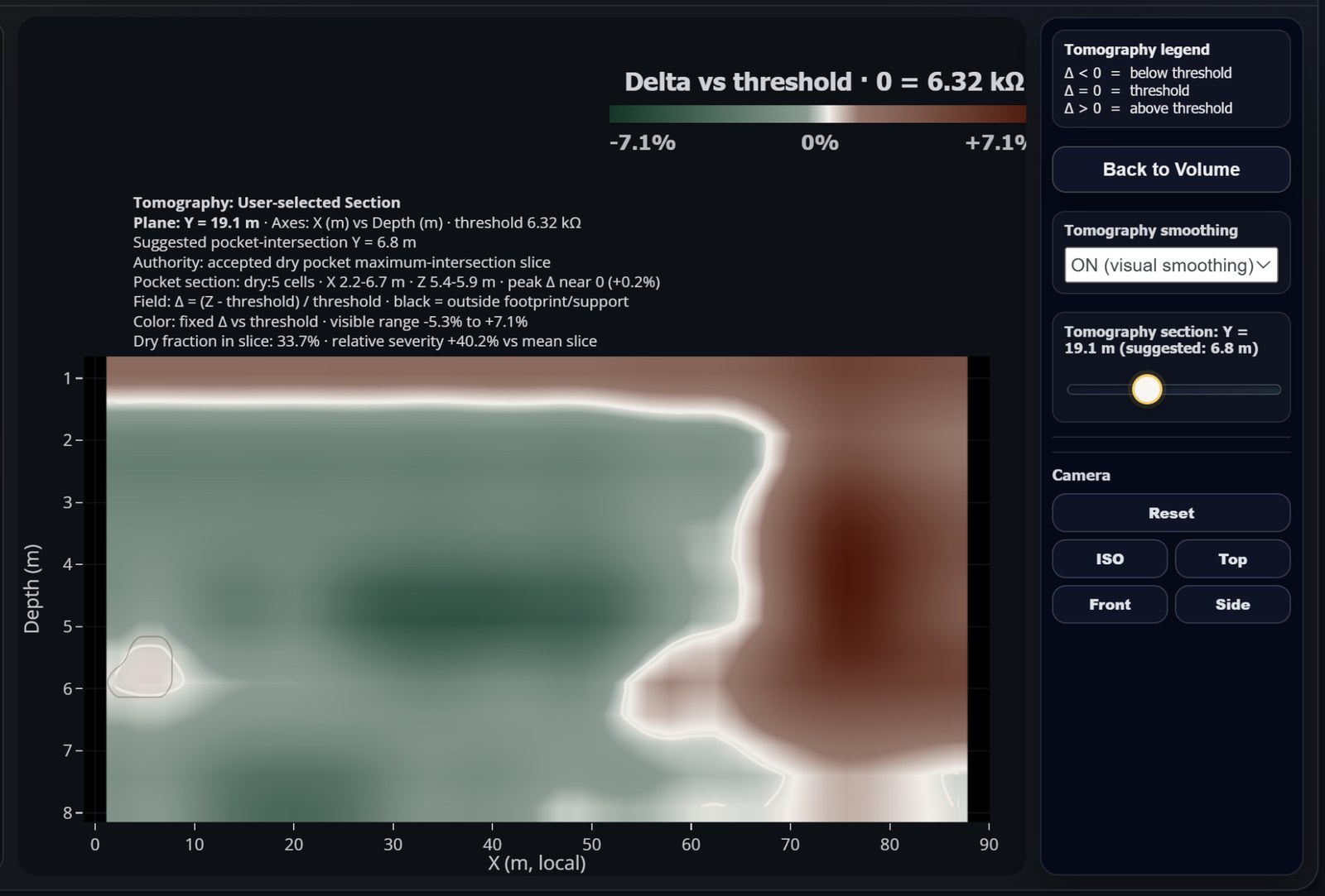
Critical sections
Beyond 3D and depth maps, the platform can review the internal heap condition in a vertical section. The view can initially focus on the most deficient or problematic irrigation section and then be moved manually to compare other sectors.
What it helps observe
The platform does not reduce the heap to a single absolute moisture value. It provides a comparative, spatial and temporal reading of irrigation within the instrumented coverage.
Persistent high relative impedance at lower levels or relevant sectors.
Localized volumes with low evidence of effective irrigation.
Spatial evolution of relative low-impedance zones associated with irrigation advance.
Relative wet concentrations that require operational review.
Patterns suggesting dominant hydraulic paths.
Comparison of snapshots to understand response to irrigation changes.
Depth review of critical sections, with manual exploration along the heap.
Start with a technically defensible sector, real data, clear hypotheses and a dashboard focused on operational value.