D
Deep dry zones
Persistent high relative impedance in lower levels or relevant sectors.
The platform helps identify patterns and critical irrigation conditions that can remain unnoticed with surface information or aggregated signals, providing evidence to better manage water resources and process solutions.
Phenomena
The objective is to support operational criteria with visual and temporal evidence.
Persistent high relative impedance in lower levels or relevant sectors.
Localized volumes showing low evidence of effective irrigation.
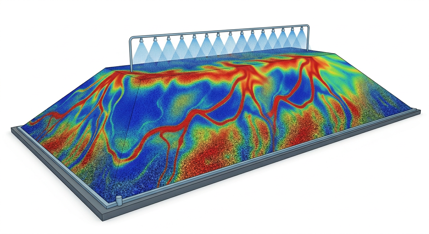
Spatial evolution of relative low-impedance zones associated with irrigation advance.
Local concentrations of relative wet condition requiring operational review.
Descent or concentration patterns that suggest dominant hydraulic paths.
Relevant spatial differences between sectors or depths.
Areas prioritized by severity, location, depth and temporal persistence.
Snapshot comparison to study response to irrigation or operating changes.
Evidence to review where irrigation distributes well, where critical zones persist and where irrigation criteria should be adjusted.
Depth review of the most critical section and manual sweep of cross-sections along the heap.
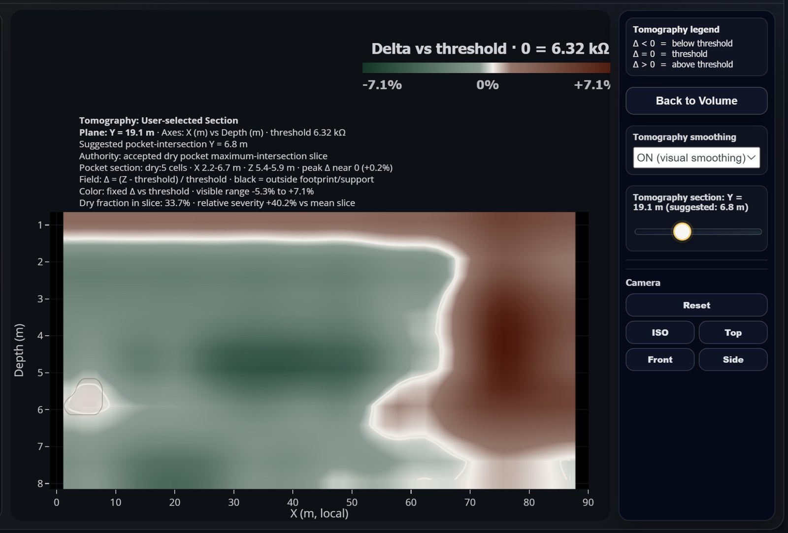
Critical section
Some hydraulic phenomena are better understood in vertical cut than in a surface view. The tomography-like visualization helps review continuity, depth, transitions and critical sectors within the instrumented coverage.
Operation
The goal is not to generate isolated alarms, but to provide evidence to decide where to look, what to compare and what to validate in the field.